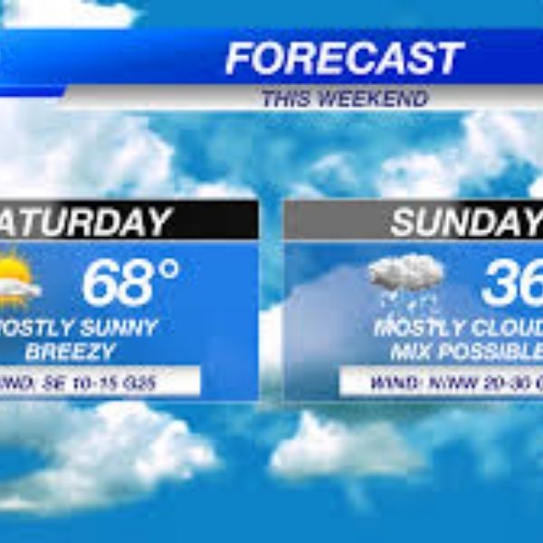
Southeast Nebraska is expected to experience a dramatic shift in weather this weekend, with warm conditions on Saturday followed by strong winds and a wintry mix on Sunday as a powerful cold front moves through the region.
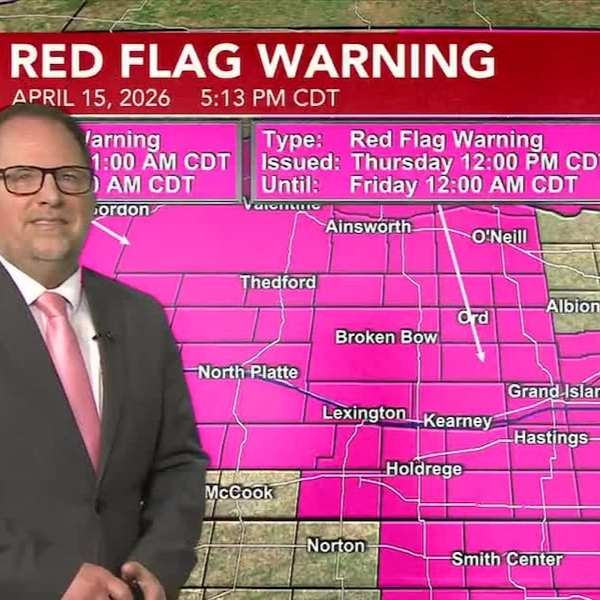
Fire weather concerns Saturday
The National Weather Service has issued a Red Flag Warning for parts of central and western Nebraska on Saturday afternoon and evening due to elevated fire risk caused by dry conditions and gusty winds.
High winds expected Sunday
Much of Nebraska is under a High Wind Watch beginning Sunday morning and lasting into early Monday. Forecasters say wind gusts could reach up to 60 mph as the cold front sweeps across the state.
Winter storm watch in northeast Nebraska
A Winter Storm Watch has also been issued for northeast Nebraska from Sunday morning through early Monday. Strong winds combined with snow could lead to hazardous travel conditions throughout the day.
Rain changing to snow
Forecasters expect precipitation to begin as rain or a wintry mix in southeast Nebraska before transitioning to snow Sunday afternoon and evening as colder air moves in.
Current forecast models suggest lighter snow accumulations, but blowing snow and strong winds could still make travel difficult.
Temperature outlook
-
Friday night: Lows near freezing with variable clouds
-
Saturday: Breezy and warm with highs in the 60s and 70s
-
Sunday: Colder with strong winds and a chance for rain changing to snow
The colder air will continue into Monday morning before temperatures rebound later in the week, with highs returning to the upper 40s by St. Patrick’s Day and climbing into the 70s and 80s by the end of the work week.


Leave a Comment