HASTINGS, Neb. (KSNB) — After a brief cooldown, temperatures are set to surge on Thursday, bringing near-record warmth along with elevated wildfire risk. A dramatic shift follows into the weekend, with subfreezing temperatures expected by Saturday and Sunday mornings.
This Evening/Overnight:
A few isolated showers or thunderstorms early this evening will fade around sunset. Skies will clear overnight with light winds, and temperatures will drop into the 40s.
Thursday through Saturday Night:
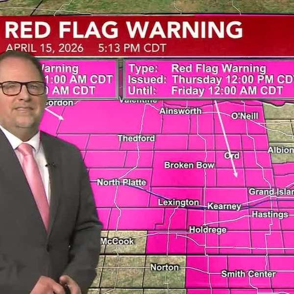
Thursday will be sunny, warm, and very breezy, increasing wildfire danger across much of the area during the afternoon and evening. Highs will reach the mid to upper 80s, with south winds of 15 to 25 mph and gusts up to 35 mph.
A cold front will move in from the northwest Thursday night, passing through the Tri-Cities area by early Friday morning. Winds will shift to the north and strengthen, with gusts up to 40 mph. Temperatures will start in the 50s and 60s Friday morning but quickly fall into the 40s and 30s behind the front.
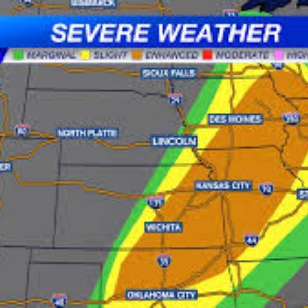
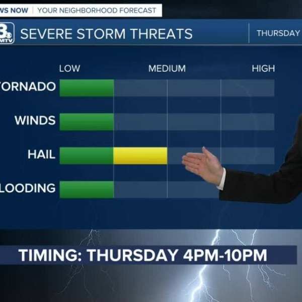
The fast-moving front will likely push severe storm chances into far southeastern Nebraska, with a greater risk developing farther south and east. Rain or snow chances on the backside of the system appear limited, mainly affecting western parts of the state.
Friday will be chilly and windy, though some sunshine may allow highs to reach the 40s and 50s. Southeastern areas may briefly stay warmer before the front passes.
Friday night will turn cold, with lows ranging from the lower 20s in the west to the low-to-mid 30s in the southeast. Another cold night follows Saturday, with most areas dropping below freezing again.
Saturday itself will be mostly sunny and slightly below average, with highs in the mid-50s north to mid-60s south.
Sunday and Beyond:
Temperatures rebound quickly on Sunday, with highs climbing from the upper 60s in the northeast to the lower 80s in the southwest.
Even warmer conditions arrive Monday through Wednesday, with highs in the 80s and possibly low 90s. By Thursday, temperatures may ease slightly as another system approaches, bringing renewed chances for rain and thunderstorms.


Leave a Comment