A round of scattered storms will kick off the weekend, but rain won’t last all day Saturday or Sunday. Temperatures in Omaha could approach 80 degrees by Sunday afternoon.
A stormy start to the weekend comes with a warming trend.
3 THINGS TO KNOW
A stormy start to the weekend
Severe weather ingredients in place
Temperatures climbing into the 80s
FORECAST
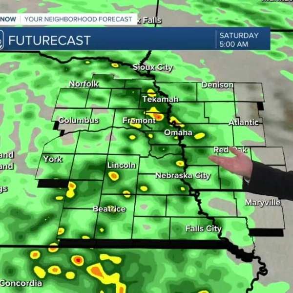
Conditions will remain dry Friday evening, with chilly temperatures in the 40s. Overnight, spotty rain and storms will move in after 2–3 a.m., bringing a wet start to Saturday morning.
Off-and-on storms are expected Saturday morning, with a chance of small hail, similar to earlier this week. Conditions will turn drier in the afternoon, with temperatures staying in the 40s and 50s.
A warm front will arrive late Saturday, pushing temperatures quickly into the 60s. There is a slight chance of storms late in the day and into the evening, with the potential for large hail.
Sunday is trending drier, breezy, and warmer, with highs in the upper 70s to near 80. A few isolated storms may develop in the afternoon heat, especially in Iowa, with a possible severe weather risk.
Monday will bring even warmer conditions, with sunshine and highs in the 80s. A few storms could move in Monday night from the south, possibly bringing hail.
Tuesday may turn wet and stormy as a cold front moves through, increasing the risk of severe weather, with highs near 80.
Rainfall totals are expected to range from 0.50 to 1.00 inches through Tuesday night.
The rest of next week looks drier and warmer than average, with highs in the 70s from Wednesday through Friday.
FRIDAY NIGHT
Storms developing late
Overcast
Low: 45
Wind: NE 10–15
SATURDAY
Stormy morning
Mostly cloudy
High: 72
Wind: NE 10–15


Leave a Comment