Strong winds are expected to move across the Northern Plains into the Upper Midwest early this week, bringing dangerous travel conditions. Gusts could reach up to 90 mph in some areas, especially along I-15.
Meteorologist Michael Estime said powerful winds will impact the region, with gusts exceeding 50 mph in some locations while wind chills drop into the single digits.
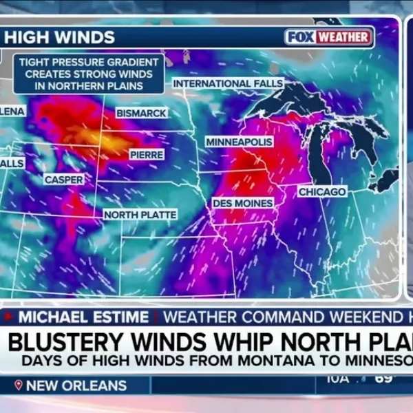
The main areas affected include Montana, the Dakotas, Minnesota, and Nebraska. A High Wind Watch has already been issued for parts of Montana on Tuesday.
The FOX Forecast Center said power outages are possible, though they are more likely in higher elevations.
From late Monday through Wednesday, strong winds are expected to develop as a tight pressure gradient forms between high pressure building behind a departing system in the Northeast and a new low-pressure system moving in from the Pacific Northwest.
Wind gusts of 30 to 40 mph are likely across much of the region, with stronger gusts possible depending on the path of the low-pressure system.
Along I-15, from Bozeman to the Great Falls area in Montana, gusts could exceed 90 mph.
Forecasters warn that crosswinds could create dangerous driving conditions, especially for high-profile vehicles that are more vulnerable to strong gusts.
Residents and travelers are urged to stay alert as the system moves through the region.
Stay tuned for updates as FOX Weather continues to monitor the situation.


Leave a Comment