Rain has moved in, and steady showers will continue over the next few days. There’s also a chance of severe weather Thursday morning and again Friday afternoon.
Rainy Start to Thursday Morning
3 THINGS TO KNOW
- Wet pattern continues through Friday night
- Severe weather possible Friday
- Cooler, drier weather arrives for Easter weekend
FORECAST
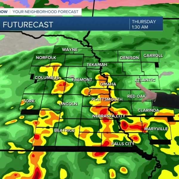
Widespread rain will develop across the area this evening. Overnight, a few thunderstorms will mix in, with pockets of small hail possible. The risk of severe weather remains low overnight and into the morning, though the final round of morning storms could bring gusty winds.
Rain will clear around noon, leaving Thursday afternoon and evening drier with highs in the 50s.
Another round of rain arrives Friday, along with the possibility of a few stronger thunderstorms. The highest risk for severe weather will be south and east of Omaha, including southeast Nebraska and southwest Iowa, mainly between 2 p.m. and 7 p.m. Other areas will see periods of heavy rain lasting into Friday night.
By Friday night, many rain gauges could show totals between 0.50″ and 1.50″.
Rain is now expected to move out before the weekend, making Saturday drier but cooler and windy, with highs in the upper 40s.
For Easter Sunday, expect a chilly morning in the upper 20s, followed by afternoon sunshine with highs in the mid-50s and lighter winds.
Temperatures will stay near early April averages, reaching the upper 50s during the first part of next week. Another chance of rain arrives next Wednesday.
WEDNESDAY NIGHT
Mostly cloudy
Stormy
Low: 45
Wind: N 15–20
THURSDAY
Mostly cloudy
Morning storms
Dry afternoon
High: 53
Wind: E 15–20


Leave a Comment