UNITED STATES — Long-range forecast models are signaling a potentially significant early April storm system that could impact multiple states from the Central Plains to the Midwest and Ohio Valley around April 2.
Although still several days away and subject to change, the setup points to a classic spring storm capable of producing a wide range of weather hazards, including snow, ice and thunderstorms across different regions.
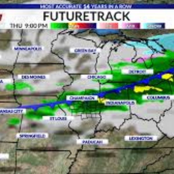
Developing storm pattern across the central U.S.
Forecast guidance suggests a strengthening low-pressure system forming over the central United States, with pressure near 1001 mb, indicating a fairly organized storm.
The setup includes:
A strong low-pressure center developing near Kansas and Missouri
Cold air wrapping into the system from the northwest
Warm, moisture-rich air surging northward ahead of the storm
This combination is commonly associated with dynamic spring systems that can generate multiple types of weather simultaneously.
Snow expected in western Nebraska and nearby areas
On the colder side of the storm, western Nebraska and parts of the High Plains could see accumulating snow.
Key points include:
Snow developing as colder air wraps around the system
Potential for late-season snowfall in western Nebraska
Possible travel impacts depending on storm strength and track
While notable for early April, this type of snowfall is not uncommon for the region.
Narrow ice transition zone possible
Between the snow zone and the warmer rain area, models indicate a narrow transition band where freezing rain or sleet could develop.
This zone may affect parts of:
Eastern Nebraska
Northern Kansas
Portions of Missouri and possibly Iowa
Even a narrow band of ice could create hazardous travel conditions, especially if temperatures remain near freezing.
Severe storm risk expands eastward
On the warmer side of the system, conditions appear favorable for rain and thunderstorms, with some storms potentially becoming severe.
Areas at risk include:
Missouri
Illinois
Indiana
Ohio
Possible threats include:
Strong to damaging wind gusts
Large hail
Locally heavy rainfall
The overall severity will depend on how much instability and moisture return ahead of the storm.
A pattern worth watching
Meteorologists note that this system may be part of a recurring late-month storm pattern, with similar setups occurring near the end or beginning of recent months.
While the idea of a “30-day cycle” remains debated, frequent storm systems during seasonal transitions are well established.
What this means going forward
Even though the storm is still several days away, early signals suggest:
A multi-hazard event across several states
Snow in the west, ice in the transition zone and storms in the east
Potential travel and weather impacts across a large portion of the central and eastern United States
Residents across the Plains, Midwest and Ohio Valley should continue monitoring updates as details such as storm track and intensity become clearer in the coming days.


Leave a Comment