Omaha — Bitter cold is expected to move into eastern Nebraska by early Monday as strong winds and falling temperatures combine to create dangerous wind chills across the region.
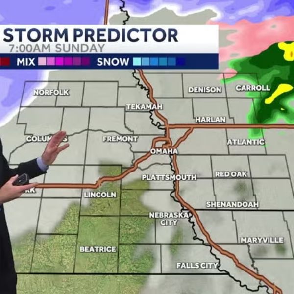
According to the National Weather Service office in Omaha/Valley, a powerful weather system moving through the Plains this weekend will bring gusty winds and periods of snow from late Saturday into Sunday. The storm could create minor but widespread travel issues across eastern Nebraska and western Iowa.
Forecasters say snowfall totals remain uncertain, but strong winds could lead to blowing snow and slick roads, especially along major routes such as Interstate 80 and Interstate 29, as well as rural highways throughout the region.
Dangerous cold arriving after the storm
The biggest concern is expected after the storm passes, when colder air moves in behind the system. Meteorologists say wind chills could fall between -10°F and -20°F by Monday morning.
The coldest conditions are expected in areas north and west of Omaha, including communities such as Norfolk, Columbus and Fremont.
Wind chills at those levels can cause frostbite on exposed skin within a short period, particularly during the early morning commute.
Safety reminders
Residents are encouraged to:
-
Dress in multiple warm layers
-
Limit time outdoors during the coldest hours
-
Check on vulnerable neighbors and pets
-
Keep a winter emergency kit in vehicles in case of travel issues
Cold conditions are expected to continue into early next week before temperatures gradually recover later in the week.


Leave a Comment