UNITED STATES — A major two-day severe thunderstorm threat is building across the Great Lakes region, beginning Monday night, March 30, and continuing through Tuesday, March 31, 2026. Storms are expected to develop around sunset Monday and persist overnight, followed by a second, more widespread round pushing east across the Great Lakes and Ohio Valley on Tuesday. This setup also signals a broader pattern shift that forecasters say could bring near-daily severe weather across the Plains and Eastern United States through Easter weekend.
Both outlooks were issued on March 29, 2026, at 4:30 AM ET.
How the Two-Day Event Develops
This is not two separate systems but one continuous storm event tracking eastward across the Great Lakes over a 36-hour period.
Monday night, March 30 — Thunderstorms begin forming around sunset across Wisconsin, northern Illinois, and Iowa. As daytime heating transitions into evening instability, the first round of severe storms is expected along a corridor stretching from La Crosse and Wausau through Green Bay, Milwaukee, Rockford, Chicago, and Davenport. Storms will continue into the overnight hours before gradually moving east.
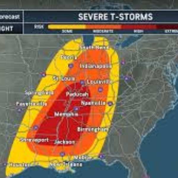
Tuesday, March 31 — The threat grows significantly. The severe weather zone extends from Davenport and Peoria through Chicago, Madison, Grand Rapids, Detroit, Cleveland, Erie, Buffalo, and Syracuse, covering a much larger area than Monday night. Tuesday presents the greater risk, with storms spreading into the Ohio Valley and reaching western New York.
Cities in the Monday Night Severe Thunderstorm Zone
Chicago, Illinois
Milwaukee, Wisconsin
Green Bay, Wisconsin
Wausau, Wisconsin
Rockford, Illinois
La Crosse, Wisconsin
Baraboo, Wisconsin
Davenport, Iowa
Dubuque, Iowa
Waterloo, Iowa
Grand Rapids, Michigan
Kalamazoo, Michigan
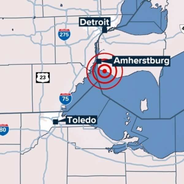
Toledo, Ohio
Detroit, Michigan
Cities in the Tuesday Severe Thunderstorm Zone
Chicago, Illinois
Peoria, Illinois
Davenport, Iowa
Madison, Wisconsin
Green Bay, Wisconsin
Grand Rapids, Michigan
Detroit, Michigan
Fort Wayne, Indiana
Cleveland, Ohio
Erie, Pennsylvania
Buffalo, New York
Syracuse, New York
Alpena, Michigan
The Bigger Picture — Ongoing Severe Weather Through Easter
Monday night and Tuesday mark the start of a longer stretch of active and potentially dangerous weather. Forecasters expect this pattern to continue across the Plains and Eastern United States through Easter weekend.
A series of upper-level disturbances moving across the country will repeatedly trigger storm development. At the same time, moisture from the Gulf will continue to build, increasing the potential for severe weather across a broader region each day. Residents from the Plains to the East Coast should view this as the beginning of a multi-day severe weather period requiring consistent attention through the holiday weekend.
Forecast Confidence Level
There is high confidence in severe storm development Monday night across Wisconsin, Illinois, and Iowa, with timing and coverage well established.
Confidence is also high for Tuesday’s expanded risk across the Great Lakes and Ohio Valley, as forecast models consistently show the system shifting east.
Forecasters also express high confidence in the extended active pattern through Easter, with multiple systems expected to move across the Plains and Eastern U.S.
There is medium confidence in the exact timing of storms Monday night, as sunset-driven storm development can be difficult to pinpoint. Residents should stay alert from late afternoon onward rather than relying on a specific time.
What Residents Should Do Before Monday Evening
Activate severe weather alerts before Monday evening. Storms developing near sunset can intensify quickly, bringing damaging winds, large hail, and isolated tornadoes with little warning.
Secure outdoor items ahead of time. Wind gusts exceeding 60 mph can turn loose objects like patio furniture and trash bins into hazards.
Identify your safe shelter location in advance. Choose an interior room on the lowest floor of a sturdy building, away from windows, for protection during tornado warnings.
Tuesday poses a greater threat than Monday night. Areas including Detroit, Cleveland, Buffalo, and Syracuse should pay close attention, as the system strengthens and moves east. Stay updated with Monday evening forecasts for refined guidance.
Prepare for continued storm risks through Easter. This is not a short-lived event but the start of an extended active pattern. Keep alerts enabled and monitor forecasts daily through the holiday weekend.
The Bottom Line
Severe thunderstorms may impact the Great Lakes, Ohio Valley, and western New York from Monday night through Tuesday. Cities such as Chicago, Milwaukee, Green Bay, Detroit, Cleveland, Buffalo, and Syracuse are all within the risk area during this period. More importantly, this marks the beginning of a prolonged stretch of active severe weather across the Plains and Eastern United States, with near-daily storm chances expected through Easter weekend. Stay alert — this is only the beginning.
Stay informed before severe weather strikes. Visit cabarrusweekly.com for daily updates, storm alerts, and nationwide forecast coverage — because early awareness makes all the difference.


Leave a Comment