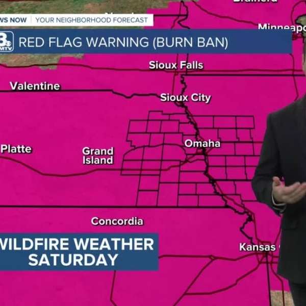
Cool and windy conditions are expected tomorrow with minor chances for precipitation. Rain chances will improve later in the week.
HASTINGS, Neb. (KSNB) — Good evening and Happy Easter! After a pleasant day, a cold front will move through this evening, bringing cooler temperatures and windy conditions for tomorrow. Rain and snow showers are possible tomorrow afternoon across northern Nebraska, with a few more chances continuing into Tuesday morning. Temperatures will warm up by Wednesday, followed by multiple chances for rain heading into the weekend.
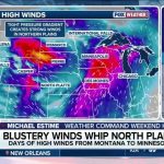
Tonight/Tomorrow: Temperatures will drop into the low to mid-30s tonight. Winds will strengthen through the morning and into the afternoon. A band of rain and light snow is expected to develop across northern and northeastern Nebraska tomorrow afternoon, with little to no accumulation. Highs will reach the low to mid-40s in northern Nebraska, low to mid-50s in central areas, and low 60s in northern Kansas. Overnight, isolated snow showers may form across western Nebraska and move east into Tuesday morning.
Tuesday Into Wednesday: Early morning snow showers will transition into rain as they move out of eastern Nebraska. Highs Tuesday will stay in the 40s in northeastern Nebraska, upper 50s to low 60s in central areas, and low to mid-60s in the southwest. Isolated showers may develop Tuesday night across central and eastern Nebraska. After a warm front passes, temperatures will climb into the 60s and 70s with windy conditions. Another cold front is expected Wednesday afternoon, possibly bringing a few showers or thunderstorms, though severe weather is not expected at this time.
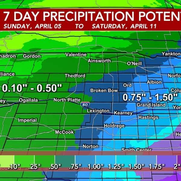
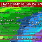
Thursday Into the Weekend: Temperatures will remain in the 60s Thursday with breezy conditions. Showers Thursday evening are expected to transition into widespread light rain overnight into Friday morning. Highs will stay in the 60s Friday, with another chance for showers and thunderstorms later in the evening. Temperatures will rise into the 70s Saturday, with increasing chances for thunderstorms through the afternoon and evening. Sunday will also see highs in the 70s with another chance for storms. There is a possibility of strong to severe storms over the weekend, though uncertainty remains regarding the track of the systems. Overall, rainfall totals could range from 0.50 to 2.00 inches through next weekend, with higher amounts likely in eastern Nebraska. The active weather pattern is expected to continue into mid-April.


Leave a Comment