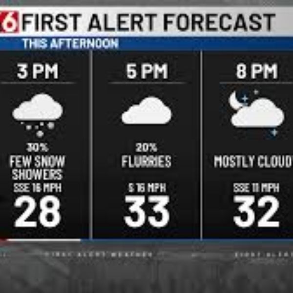
We are monitoring a weaker Kona low that could develop west of the state in the coming days. This system could bring periods of heavy rain on Thursday.
Forecasters expect the developing low to be weaker than the recent storm that impacted the state. As of Monday evening, the heaviest rainfall is likely to favor leeward areas. However, weather models are still having difficulty determining exactly which locations will receive the most rain.
Flash flooding continues to be a concern, as the ground is already saturated. Since the soil cannot absorb much more water, additional downpours may trigger rapid runoff and cause localized flooding.
Heavy rain remains possible with the next Kona Low, and officials urge anyone recently affected by flooding to stay alert this week — even though the overall risk is lower.
There is also a possibility of heavier rainfall heading into the weekend.
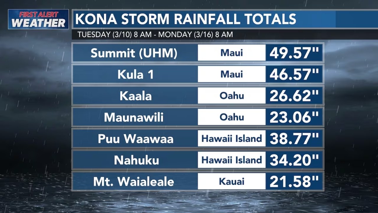
Below are the five-day rainfall totals from the most recent Kona storm.
Surf and winds: Winds are not expected to pose a concern with the approaching Kona Low system. Light southerly winds will develop on Thursday and continue through the weekend. Light trade winds may return from Monday into Tuesday.
Surf along north and west-facing shores is increasing as a northwest swell moves across the state. Surf along south-facing shores will also rise this week due to a long-period south swell. The south swell will peak on Wednesday and Thursday before gradually easing through the weekend.


Leave a Comment