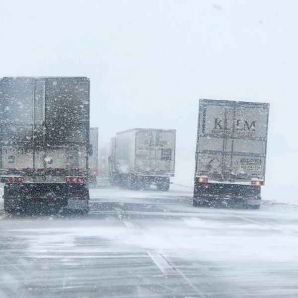
A Weather Alert Day remains in effect this evening into Monday morning due to strong winds and very cold temperatures.
HASTINGS, Neb. (KSNB) – The Weather Alert Day continues through this evening and into Monday morning. Strong winds will gradually weaken overnight but conditions will remain breezy on Monday. Combined with frigid morning temperatures, the start of the day will feel extremely cold.
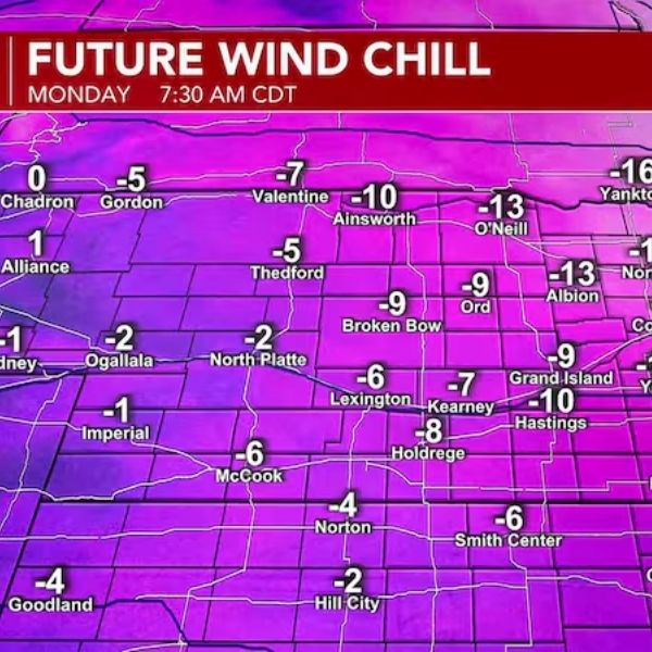
Tonight and Monday: Winds will slowly decrease overnight, reducing the threat of damaging gusts. However, they will still be strong enough to make the already cold air feel even colder. Low temperatures early Monday morning will drop into the single digits and lower teens. Wind chill values will fall to around 0° or even colder. The coldest wind chills, ranging from -5° to -15°, are expected across the eastern half of the area, with parts of Northeast Nebraska possibly seeing values near -20°. Monday will bring more sunshine, though temperatures will remain seasonably chilly. Highs are expected to range from the upper 20s in the northeast to the low and mid-40s in the southwest.
Tuesday and Beyond: Temperatures will rise quickly on Tuesday, with highs reaching the upper 40s in the east and climbing to the mid and upper 70s in the west. The warming trend will continue through the rest of the week as winter comes to an end. Spring officially begins on Friday. Highs on Wednesday could reach the upper 70s and low to mid-80s. Temperatures on Thursday and Friday are expected to range from the upper 70s to upper 80s, with some areas of Southwest Nebraska and Northwest Kansas potentially reaching 90°.


Leave a Comment