
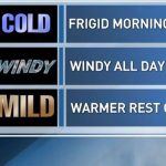
OMAHA, Neb. (WOWT) — A First Alert is in place as the coldest morning and coldest day of the week begin, ahead of a rapid warming trend.
Wind chills dropped into the double digits below zero early this morning, ranging between -5 and -15. Conditions are expected to gradually improve as winds decrease throughout the day.
Today
Temperatures will climb into the 20s this afternoon with sunshine. That combination may help melt some of the ice on roads and sidewalks.
Tuesday
A few light snow showers are possible Tuesday, mainly north of the metro area. Any accumulation is expected to be minimal, with around a half inch or less if it sticks.
South winds could gust between 20 and 30 mph during the afternoon.
Warming trend ahead
A major warm-up begins Wednesday, with highs jumping into the 60s. Even warmer air follows, with temperatures reaching the 70s Thursday and likely climbing into the 80s by Friday and Saturday.
Friday’s high in the lower 80s could break a record.
The first day of spring is shaping up to bring unusually warm conditions.


Leave a Comment